Winter weather continuing through the week, with more snow predicted
Driving conditions are difficult throughout Coastal Washington this morning as heavy snow and an overnight freeze have turned roads into sheets of ice.
The National Weather Service is predicting that very cold temperatures will continue through Wednesday of this week.
Locally, you can expect a moderate chance of snow over the coming days, with a weak “disturbance” brushing the area tonight into Tuesday, bringing additional snow showers to the region.
Accumulations are expected to remain light, with the highest snow totals expected along the Washington coast and in the Southwest interior.
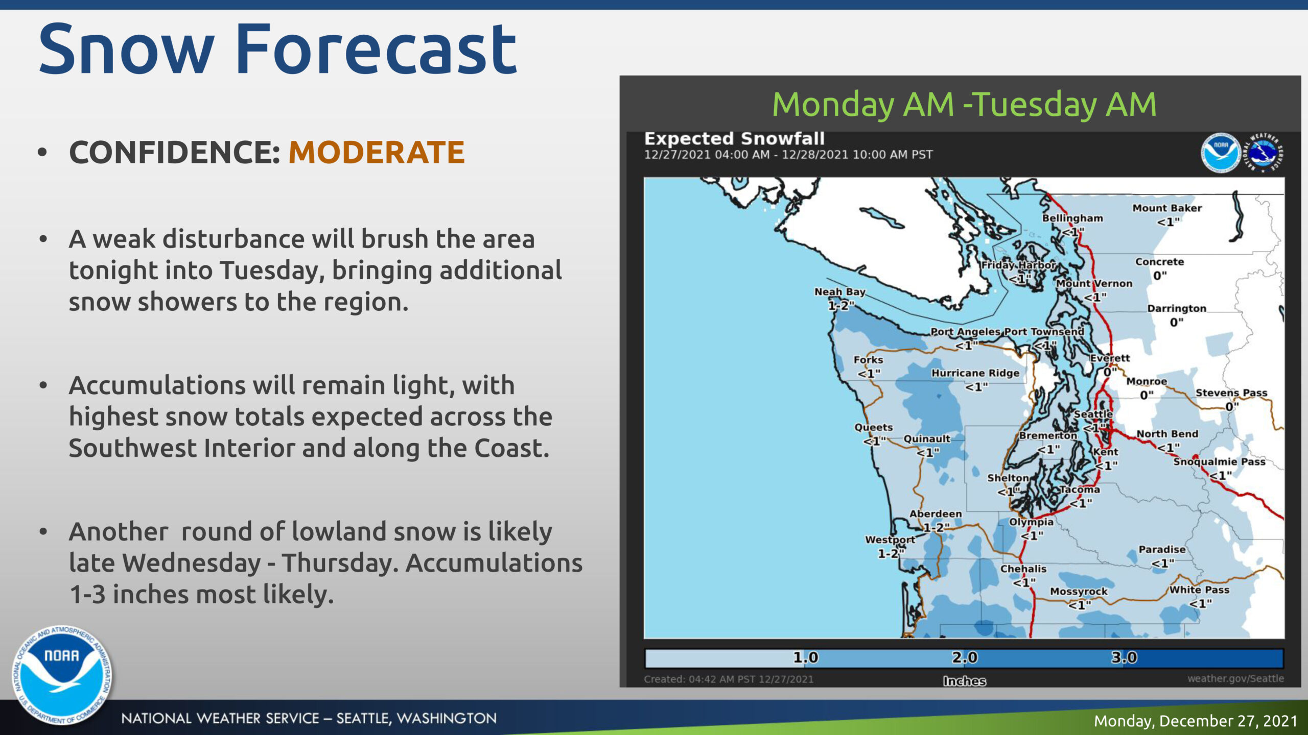
A period of lowland snow is likely late Wednesday night through early Friday with somewhat warmer temperatures. This round of weather is likely to bring another round of lowland snow with 1-3 inches likely.
There is a slight chance of freezing rain.
A second lighter round of lowland snow and patchy freezing rain possible Saturday.
You Might Also Like